NYSDEC Stormwater Permit and Manual 2015 Update
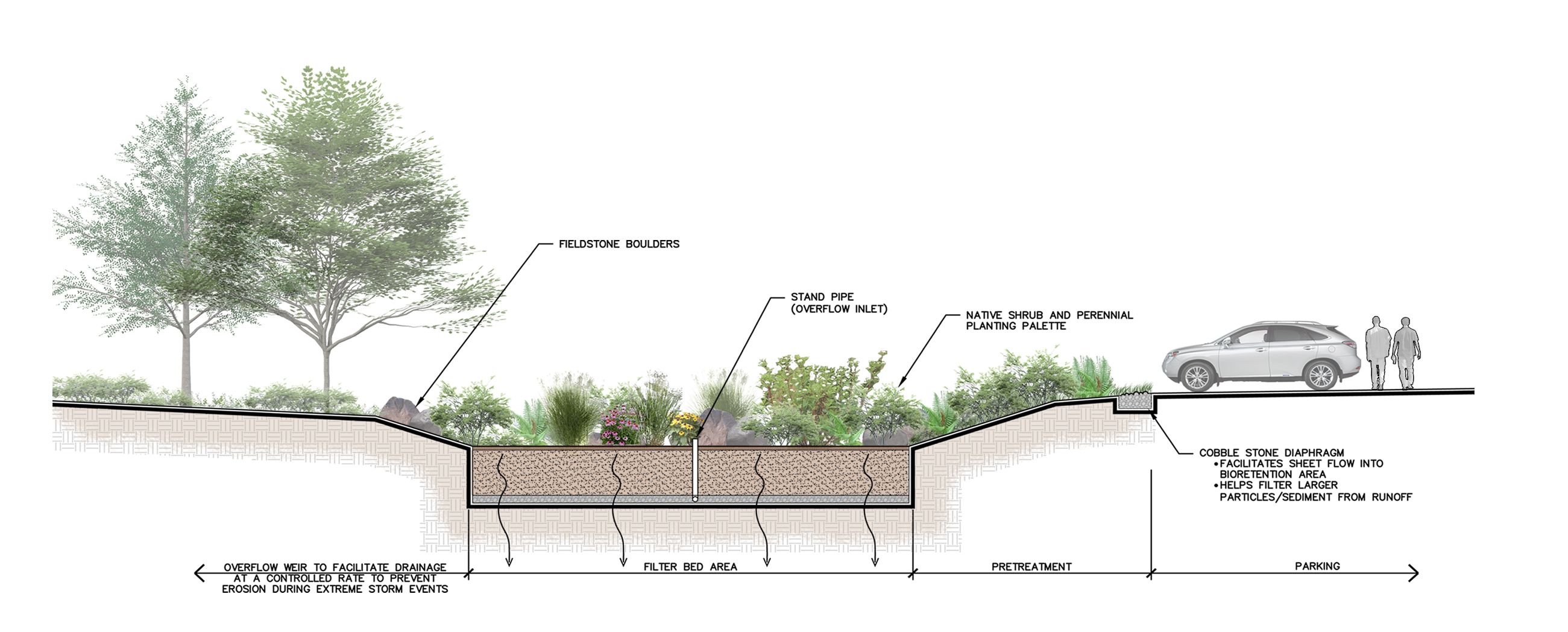
Bioretention Basin
This past January, the NYSDEC renewed the State Pollutant Discharge Elimination System (SPDES) General Permit for Stormwater Discharges and the NYS Stormwater Management Design Manual. With over 600 pages of detailed information, we wanted to make sure you were aware of all of the changes, large and small.
For your convenience, our engineers have pulled together the “must know” elements that could affect your properties or plans. From rainfall depths, stormwater ponds, and inspection schedules, to cultural and archeological documentation – an overlooked item could stand between you and your permit.
What you need to know
A SPDES General Permit for Stormwater Discharges is required for construction activities involving soil disturbance of one (1) or more acres. For construction activities located in the New York City watershed east of the Hudson River, the soil disturbance limit is set at five thousand (5,000) square feet.
The NYSDEC SPDES General Permit for Stormwater Discharges emphasizes the following requirements:
- Stormwater Management must be an integral part of the building and site design process and must be incorporated into the design at preliminary planning stages.
- The use of multiple smaller stormwater management practices as opposed to a single large pond.
- Infiltration and volume reduction is critical and a requirement for all projects. Green infrastructure methods must be utilized. Green infrastructure methods include, but are not limited to, infiltration ponds, green roofs, porous pavement, and bioretention basins.
- Significant emphasis is placed on archeological consultation. Start this process early!
- Regulations promote redeveloping existing disturbed sites and provide incentive by allowing reduction in the size of stormwater management systems.
The good news is, The LA Group has expertise in creatively implementing stormwater management techniques to function as project amenities, adding value to a project.
Use the items below as a cheat sheet for the updates effective January 29, 2015. For complete documentation and details, visit:
- NYS Department of Environmental Conservation Stormwater Overview
- NYS Stormwater Management Design Manual
- SPDES General Permit for Stormwater Discharges
Have questions? Contact Douglas Heller, P.E., Civil Engineer, at The LA Group.
Stormwater Manual Updates
Rainfall Depths
- 24-hour rainfall depths were revised for the 1-year, 10-year, and 100-year storm events throughout the State of New York. Depending on the project location, depths may have increased or decreased.
- 90% rainfall depths have increased throughout the State. Water quality volume requirement is based on this rainfall depth. Stormwater management devices will need to slightly increase in size.
Runoff Reduction
- Percentage of Water Quality Volume (WQv) that can be applied to meeting the Runoff Reduction Volume (RRv) requirement has been increased to 100% for Infiltration Basins and Bioretention Basins situated in Hydrologic Soil Groups ‘A’ and ’B’.
Redevelopment
- Language in Chapter 9-Redevelopment Projects was rewritten to clarify when a project is a Redevelopment and its associated sizing criteria requirements.
Stormwater Ponds
- Language was added and a diagram provided clarifying that an aquatic bench must be an average of 15’ wide and vegetation must be established prior to the pond being rendered in-service.
- A new requirement was added to ponds necessitating the use of warning signs prohibiting swimming, wading, and skating. The signs must warn of possible contamination or pollution of pond water and indicate the maximum depth of pond.
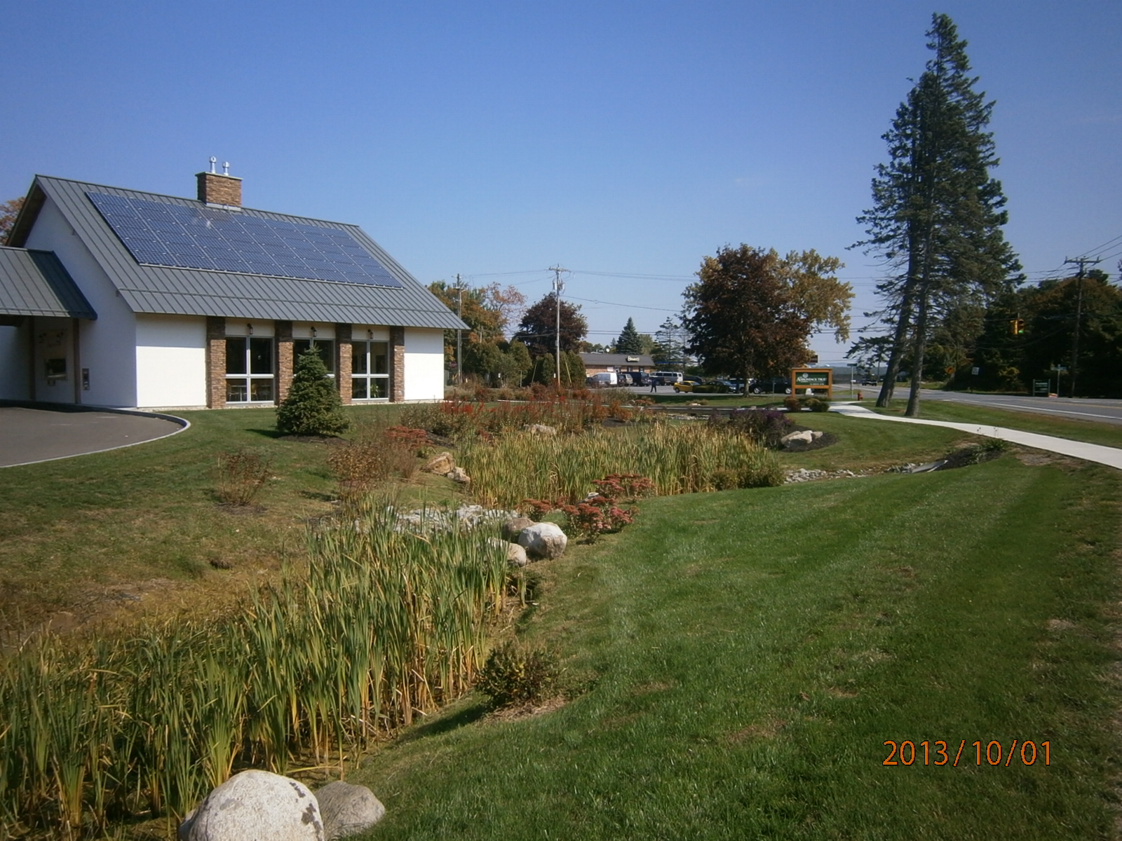
Pocket Pond
General Permit Updates
Notice of Intents (NOIs)
- Review period for paper Notice of Intents (NOIs) was increased to 10 days. If an electronic NOI is submitted, then the review period is 5 days.
- If a Stormwater Management Practice is not designed in conformance with the Design Manual, then the SWPPP and NOI must include reason for deviation or alternative design and demonstrate that the design is equivalent to the technical standards.
- Equivalent – practice meets all performance, longevity, maintenance, and safety objective of technical standards and will provide equal or greater degree of water quality protection.
Inspections
- During construction, the number of inspections by a qualified inspector for sites discharging to 303(d) (impaired waters) has increased to two inspections per week. Additionally, in areas where soil disturbance activities have temporarily or permanently ceased, soil stabilization measures must be initiated and completed within seven days from when soil disturbance activity ceased.
Impaired Water
- List of impaired water, 303(d), has been updated and additional water bodies have been added (see Appendix E of the General Permit for the complete list).
WQv and RRv
- If your project can not fully reduce the required WQv through the implementation of RRv practices, then you must demonstrate in the SWPPP why each RRv technique is considered infeasible. A definition of infeasible was added to the General Permit.
- Infeasible – means not technologically possible, or not economically practicable and achievable in light of best industry practices.
- Language was added clarifying that Redevelopment Projects that increase impervious areas must provide RRv practices and fully treat the new impervious area.
Cultural and Archeological Documentation
- In order to obtain coverage under the General Permit, documentation must be provided demonstrating that potential impacts to archeological and/or historic resources will be avoided or mitigated prior to submission of the NOI.
- The following is the screening process that must be completed to determine if the Project has potential to impact archeological and/or historic resources:
- Check the archeological sensitivity map on the Office of Parks, Recreation, and Historic Preservation (OPRHP) CRIS website to determine if the Project is located in an archeological sensitive area, on a historic property, or immediately adjacent to a historic property (immediately adjacent means sharing a property line).
- Determine if the Project includes the construction of a new permanent building on the construction site within the following distances of an Unevaluated Property
- 1-5 acres of disturbance – 20 feet
- 5-20 acres of disturbance – 50 feet
- 20+ acres of disturbance – 100 feet
- An Unevaluated Property is a building, structure, or object that is more than 50 years old (note that the distances are from building to building).
- If the Project is within an archeological sensitive area, or on a historic property, or immediately adjacent to a historic property, then a DEC consultation form must be sent to OPRHP, copied to NYSDEC Agency Historic Preservation Office (APO), and the following documentation must be provided:
- State Environmental Quality Review (SEQR) Environmental Assessment Form (EAF) with a negative declaration or the Findings Statement, with documentation of OPRHP’s agreement with resolution; or
- Documentation from OPRHP that the construction activity will result in No Impact; or
- Documentation from OPRHP providing determination of No Adverse Impact; or
- A Letter of Resolution signed by the owner/operator, OPRHP and DEC which allows for this construction activity to be eligible for coverage under the general permit under SHPA; or
- Documentation of satisfactory compliance with Section 106 of National Historic Preservation Act; or
- Documentation that SHPA Section 14.09 has been completed by NYSDEC or another state agency
- If the Project includes a new permanent building within the set distances of an Unevaluated Property a determination should be made whether the building, structure, or object has historic significance. Consultation with OPRHP, a Historic Preservation Commission of a Certified Local Government, or a qualified preservation professional shall make this determination